The more you give to a social network, the more vulnerable you are to its obsolescence. Archived version of a text published with The Atlantic in 2014.

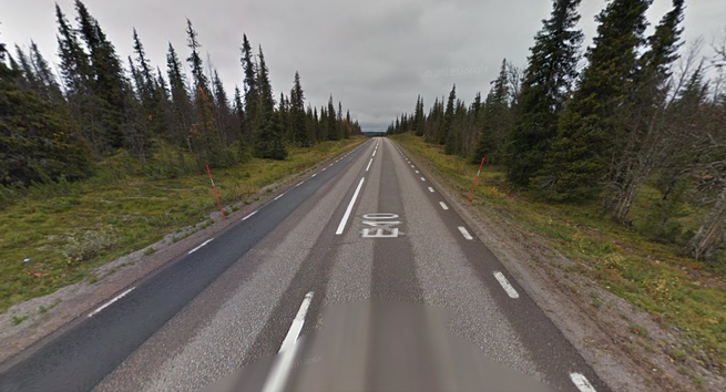
The place appeared suddenly and unexpected on my phone’s screen as we were driving through one of the less populated regions of the Northern Swedish countryside. “The little island in the middle of the lake,” read an entry in the smartphone app Gowalla, listing nearby points of interest. There weren’t many such points along the section of the European Route E10 road we were on, in a region with a very low population density and mostly flat stretches of industrial forest plantations. The road connects the industrial city Luleå in Sweden (home of Facebook’s massive new data center, cooled by the northern climate and powered by cheap local hydropower) and the picturesque fishing village Å at the very tip of the Lofoten Islands in Norway. On the way there, the road passes through mountains and arctic tundra, boreal forests and lake-dotted plains. As we passed through this landscape by car, however, we were mostly struck by the monotony of it all. Our car was filled to the brim, children and dogs and all. Halfway through the two-day trek to see family in Norway, my wife was at the wheel. I was fiddling around with my brand new iPhone, which truly seemed a magical product after years with Nokia and Sony Ericsson phones. The large touchscreen, the integrated GPS, and the 3G data connection made the phone a window to the world where data and the physical finally coexisted and interacted in a way that felt right to me. It was also a window into the behaviors of other people accessing this world. Someone—I do not know who—had used Gowalla to tag this little island in the middle of the lake as a point of interest, and so the island became interesting to me. The chance meeting with this island, which existed to me only as a data point, has remained in my mind for years. What did the existence of…

A discussion of the Hurtigruten – minutt for minutt slow TV show.

Hurtigruten comes to my hometown Sortland, June 20, 3:30am. Midnight sun to the right.

I have come to the conclusion that I like my entertainment slow. I generally don’t watch TV, but the last few days I have been glued to the TV, watching the 8048-minute long live broadcast of Hurtigruten sailing from Bergen to Kirkenes, along the Norwegian coast. As you might expect, the show is very slow – we get to see the view from the ship, mixed in with interviews and commentaries onboard the ship, all in realtime. The TV station NRK2 shows everything live (and I get it through my cable TV here in Sweden), and a website shows the video stream with a good map and other information (more on the website below). The show has been a big hit in Norway – some 1.3 million people (of Norway’s roughly 5 million people) watched the show Thursday and Friday, which are quite impressive numbers, and I expect the weekend ratings will be even higher. The hashtag #hurtigruten has been quite active on Twitter as well. I’m not surprised that people are watching the show, but it’s been even more interesting to see all the people that show up along the coast, waving from land, cruising around in boats, and also the huge crowds at all the stops. The small places are generally the ones with the most people. My hometown Sortland (with 10,000 inhabitants), for instance, had more people show up at 3:30 at night than Trondheim (with 175,000 people) had in the middle of day. It seems like the experience of the show took people somewhat by surprise – the premise sounds quite ludicrous, like watching paint dry on live TV, but people took a look out of pure curiosity and then found it hard to stop. Twitter is full of people who seemed unable to turn off the TV and go to bed at night as Hurtigruten sailed through Vesterålen in the midnight sun. I think there are many reasons why the Hurtigruten show stuck…

Reflections on place, geolocation, and digital photography, written at a time before such practices were ubiquitous.

There has been some uproar the last few days about the spatial data embedded in the iPhone backups – which has been transmitted to Apple. Since Alexis Madrigal asked to see other people’s maps, out of curiosity, here’s mine. I used the free iPhone Tracker software made by Alasdair Allan and Pete Warden to generate these maps. Here is my world map. As we can see, I spend most of my time in Northern Europe, but I’ve had several stops in the US. Of course, the data set is limited to the time since I bought my iPhone, which was about 8-9 months ago. US map Looking closer at the US part, we see that I’ve been to Chicago, Seattle, Phoenix, and Santa Fe since buying my phone. Chicago sticks out as a pretty small dot – I have stopped at O’Hare a while flying to Phoenix and Seattle and must have turned on my phone. I did fly through Newark a few days ago, but must not have turned on the phone then, since it did not show on the map. New Mexico As we zoom in on New Mexico, we see clearly how the data points map out on a grid, and one might reasonably think that I did not physically go to all these locations. Supposedly, the iPhone found the location by triangulating to nearby cell phone towers. It seems like I spent much more time in Albuquerque (south) than in Santa Fe (north), which is not true at all. We flew to Albuquerque, but only spent one day there. The rest of the time we were in Santa Fe. One day we drove out to Bandelier National Monument, which we can also see to the northwest of the map. Phoenix, AZ Zooming in on Phoenix, we see two concentrations on the map. I assume the darkest dot is around the Wyndham Hotel, and going east we can see the results of our very…

Some of my first reflections on technology and the historical sense of place – eventually, this become the Locative Technologies and the Human Sense of Place project funded by the Research Council of Norway almost ten years later. Originally published on forskning.no.

En historiker er i sitt rette element i et støvete arkiv eller i et velutstyrt bibliotek. Vi kan lese gamle kortkataloger, søke i databaser og snakke med arkivarer for å finne nøyaktig det vi leter etter. Vi koser oss når vi kan utforske en haug med papirer som ingen har bladd i på mange, mange år, på jakt etter godbiter som vi kan ta med i historiene vi skriver. En historiker utvikler en helt bestemt type stedssans som er velegnet for å navigere gjennom store mengder med informasjon. Samtidig tror jeg mange blir fanget i denne informasjonens abstrakte karakter. Det sies jo at fortiden er et annet land, men fortiden er også et annet landskap. Som historikere må vi ikke bare prøve å rekonstruere en annen tid og en annen kultur – jeg vil også hevde at vi bør tenke på fortiden som et konkret sted, med tidsbundne geografiske begrensninger og muligheter. For geografi har betydning for de historiene vi forteller. En slik påstand vil nok ikke overraske mange geografer, men historikere har nok godt av å tenke over både det fysiske landskapet historiene våre utspiller seg i og hvordan den tilgjengelige teknologiske infrastrukturen formet folks opplevelse av landskapet. Dette krever imidlertid en helt annen type stedssans. Jeg har brukt mye tid de siste ukene på å lese kart og utforske gamle reiseskildringer. Helt konkret har jeg kikket på hvordan turister kom seg til Vøringfossen innerst i Hardangerfjorden. Denne var en av de store turistattraksjonene i Norge på slutten av 1800-tallet (og er det for så vidt fremdeles). I dag kan man sette seg i bilen i Bergen og kjøre helt fram til Vøringfossen på omtrent tre timer. Dersom en går tilbake til slutten av 1800-tallet så ting helt annerledes ut. Først måtte en ta dampskip opp gjennom Hardangerfjorden. Etter omtrent 14 timer i båt med mange stopp på veien kom en endelig fram til Eidfjord, hvor en i følge Dr. Yngvar Nielsens Reisehaandbog…

css.php