The place appeared suddenly and unexpected on my phone’s screen as we were driving through one of the less populated regions of the Northern Swedish countryside. “The little island in the middle of the lake,” read an entry in the smartphone app Gowalla, listing nearby points of interest.
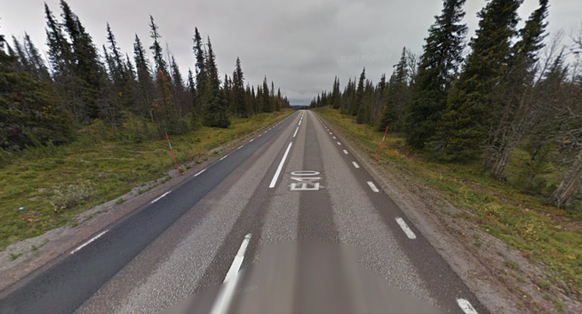
There weren’t many such points along the section of the European Route E10 road we were on, in a region with a very low population density and mostly flat stretches of industrial forest plantations. The road connects the industrial city Luleå in Sweden (home of Facebook’s massive new data center, cooled by the northern climate and powered by cheap local hydropower) and the picturesque fishing village Å at the very tip of the Lofoten Islands in Norway. On the way there, the road passes through mountains and arctic tundra, boreal forests and lake-dotted plains.
As we passed through this landscape by car, however, we were mostly struck by the monotony of it all.
Our car was filled to the brim, children and dogs and all. Halfway through the two-day trek to see family in Norway, my wife was at the wheel. I was fiddling around with my brand new iPhone, which truly seemed a magical product after years with Nokia and Sony Ericsson phones. The large touchscreen, the integrated GPS, and the 3G data connection made the phone a window to the world where data and the physical finally coexisted and interacted in a way that felt right to me. It was also a window into the behaviors of other people accessing this world.
Someone—I do not know who—had used Gowalla to tag this little island in the middle of the lake as a point of interest, and so the island became interesting to me. The chance meeting with this island, which existed to me only as a data point, has remained in my mind for years. What did the existence of the island, not as a physical place in the middle of a lake in Northern Sweden, but as a digital place discovered on my phone, really mean?
I can never again find the little island in the middle of the lake.
From the road, places like the little island in the middle of the lake were invisible and undiscoverable. The countryside could seem mostly empty for outsiders and people, like us, passing through. Yet, they are storied landscapes, inhabited for centuries by people with shifting and sometimes competing ways of using the land. There are traces everywhere. Signs by the road alert drivers to officially designated points of interest such as national parks, war memorials, the massive World Heritage Site Laponia. Travelers interested in what historian of technology David Nye calls the technological sublime can observe giant mines, hydropower plants, and the occasional wind turbine—all signs of significant human interventions in the landscape. Rickety moose-hunting towers, animal crossing signs, and black plastic sacks tied to sticks along the road—to indicate the presence of herded reindeer—hint at humans and animals co-existing and interacting, no matter how empty the road may seem at times. Look closely enough, and the land is suddenly very crowded with layers upon layers of history.
Visitors and travelers have been able to learn about these and other points of interest through maps and travel guides for a long time. Throughout the 19th century, urban travelers turned the Scandinavian countryside into a tourist destination by exploring, mapping, and writing extensively about what they considered areas worth seeing. Published since 1886, the Swedish Tourist Association’s annual book demonstrates how its authors directed visitors to particular places and vistas. For instance, the first volume provided directions to the most accessible glaciers in Lapland. Descending from the Walli mountain toward the Njåtso valley, the book advised, would give you the most spectacular views of massive glaciers.
More modern travel guides like Lonely Planet and Rough Guides belong in this tradition, but have recently come under strong pressure from digital media. Geosocial networking apps are, in other words, only the latest in a long history of making places shareable and findable through media. They should, however, be considered platforms rather than stand-alone products, dependent on crowdsourced information for all but the most iconic points of interest. The GPS-enabled smartphone gives us a dynamic window into this world. While certainly not the only possible view of space and its meanings, Gowalla and other geosocial networking apps opened up the landscape and covered it in data generated by people who had passed by, lived here, experienced these places, and then chosen to share them.
The accurate GPS navigation that these geosocial networking apps depend on is something relatively new. Patented to the Naval Research Laboratory scientist Roger Easton in 1974, the history of the GPS is a classic story of a military technology that eventually became something we think of as a common good that we all can access, not unlike the Internet. When President Bill Clinton discontinued the so-called Selective Availability practice of intentionally degrading GPS signals for the general public for national security reasons in May 2000, the geospatial consumer market exploded. Today, networked GPS sensors are ubiquitous, supporting a wide range of services and technologies.
Stories of the GPS and its influence generally focus on people being lost or not lost, of finding their way and possibly being blind to the world around them—instead experiencing it only on the screen. But my lost little island tells another story of place and location in the era of the GPS.
When Gowalla launched in 2009, a little over a year before my road trip, it was one of the first location-based social networks. Designed for GPS-enabled smartphones, Gowalla experimented with game-like features, allowing users to check into “Spots” that could again be organized into “Trips” in different categories. More importantly, users could add locations themselves, so Gowalla’s world map was populated as the service gained users around the world. Through Gowalla and competing services such as Foursquare, Yelp, Brightkite, and the more recent Findery, people tagged, ranked, and annotated the world around them, creating and interacting with complex shared representations of the places that mattered to people. These networks function as platforms for sharing and discovery of place and location, processes that generate this meaning.
While beautifully designed and loved by many of its users, Gowalla lost ground against its main competitor (Foursquare) before being purchased for the talent (sans user data) by Facebook in 2011. By then I had lost interest in Gowalla itself, as had many others, thanks to a lack of clear direction from Gowalla’s developers. I hardly noticed at the time.
A promised data-export option never materialized, so all the Spots and Trips registered by Gowalla’s users were lost. All these places that people had found and shared—the places they had made discoverable—were gone. I can never again find the little island in the middle of the lake.
The lost little island tells us something about the ephemeral nature of places in the digital world. We know that space becomes place as people imbue it with meaning over time. But places can be unmade, too, with the disappearance of the services that first made us aware of them. Physical places may continue to exist, but how integral to a place’s identity is its digital representation?
Social networks gain value as people invest their time and attention in them—as they share their lives and locations. The more people use a social network, the more valuable it is, not just to shareholders, but also as an engine for discovery. But the more of yourself and your world you invest in the network, the more vulnerable you are to its obsolescence.
The last few years have seen several new geosocial networks appear, such as Findery. Gowalla founder Josh Williams is launching a new one, too. Even with newcomers, some older networks like Foursquare are still around. Some of these will survive, but many will likely not. How many little islands will be lost with the next network to shut down?
Originally published with The Atlantic 24 June 2014.