There has been some uproar the last few days about the spatial data embedded in the iPhone backups – which has been transmitted to Apple. Since Alexis Madrigal asked to see other people’s maps, out of curiosity, here’s mine. I used the free iPhone Tracker software made by Alasdair Allan and Pete Warden to generate these maps.
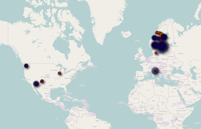
Here is my world map. As we can see, I spend most of my time in Northern Europe, but I’ve had several stops in the US. Of course, the data set is limited to the time since I bought my iPhone, which was about 8-9 months ago.
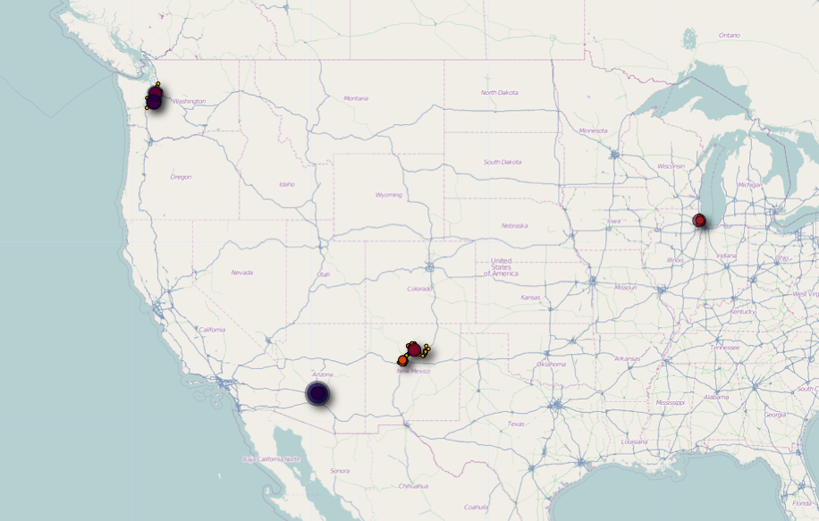
Looking closer at the US part, we see that I’ve been to Chicago, Seattle, Phoenix, and Santa Fe since buying my phone. Chicago sticks out as a pretty small dot – I have stopped at O’Hare a while flying to Phoenix and Seattle and must have turned on my phone. I did fly through Newark a few days ago, but must not have turned on the phone then, since it did not show on the map.

As we zoom in on New Mexico, we see clearly how the data points map out on a grid, and one might reasonably think that I did not physically go to all these locations. Supposedly, the iPhone found the location by triangulating to nearby cell phone towers. It seems like I spent much more time in Albuquerque (south) than in Santa Fe (north), which is not true at all. We flew to Albuquerque, but only spent one day there. The rest of the time we were in Santa Fe. One day we drove out to Bandelier National Monument, which we can also see to the northwest of the map.
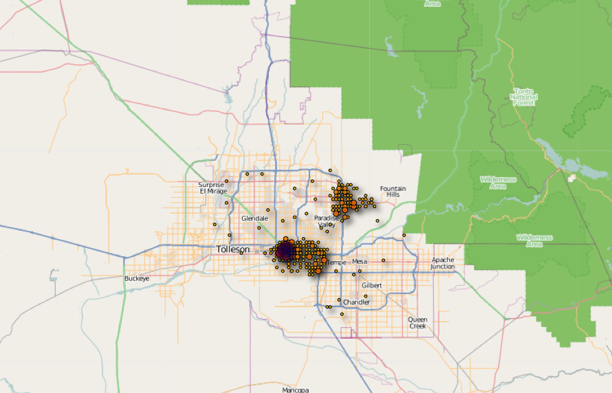
Zooming in on Phoenix, we see two concentrations on the map. I assume the darkest dot is around the Wyndham Hotel, and going east we can see the results of our very interesting bus ride to the Phoenix Zoo (reminder to self: taking the bus in the US is something entirely different than in Northern Europe…) Further up we can see a big concentration of dots around Taliesin West. Interestingly, one can’t really see the drive out there.

Jumping over to Europe, we see much traveling back and forth between northern Norway and Sweden, and big dots for Stockholm and Oslo, and smaller dots for Roskilde and Florence.

This is where it gets interesting. Here we see the results of our road trips between Umeå, Trondheim, and Mosjøen.
Finally, a zoomed in map of Umeå, the city I live in [sorry, this image got lost in a wordpress hack cleanup]. The grid is very obvious here, and the size of the dots do not accurately indicate where I’ve spent the most time (campus and my house). Instead, I think they must represent the cell phone antenna towers that register my phone the most often, and some of these must be bigger and more sensitive than others.
I like the stories that these maps tell. They also made me think of the way geotagging and mapping technologies have transformed our personal relationships to space. I wish that I had tagged every single one of the some 30,000 photos I have taken since I bought my first digital camera in the summer of 2004 (a Nikon D70, which I still use!) in time and space. I use Flickr and, increasingly, Picasaweb to share and make cloud backups of my photos, and both these services now have the option to display geotagged photos on maps. Flickr certainly seems like the best solution, since they can show all geotagged locations on a big map:

Here the map becomes a real tool for exploring places.
Picasaweb, on the other hand, only gives a tiny, cursory option to see all photo locations on a tiny little map, To see more detail, you need to look at individual albums:

Here we see again a map from our New Mexico trip. Not all that different from the iPhone generated one above.
I think personal mapping like this is still somewhat underexplored. Most advanced smartphones automatically geotag photos taken with them now, and I see that some compact digital cameras have started getting built-in GPS receivers. What will happen when all photos we take are reliably geotagged? As the last few days’ Apple controversy has demonstrated, there will be some privacy issues, but I think it holds the potential for some real exciting personal mapping services.