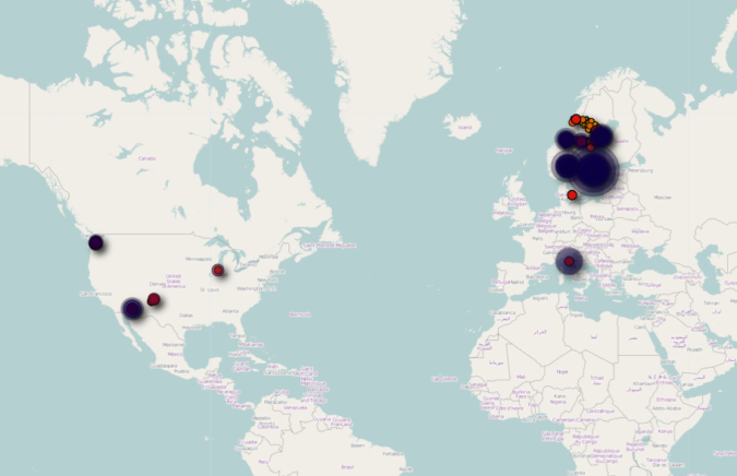
There has been some uproar the last few days about the spatial data embedded in the iPhone backups – which has been transmitted to Apple. Since Alexis Madrigal asked to see other people’s maps, out of curiosity, here’s mine. I used the free iPhone Tracker software made by Alasdair Allan and Pete Warden to generate these maps. Here is my world map. As we can see, I spend most of my time in Northern Europe, but I’ve had several stops in the US. Of course, the data set is limited to the time since I bought my iPhone, which was about 8-9 months ago. US map Looking closer at the US part, we see that I’ve been to Chicago, Seattle, Phoenix, and Santa Fe since buying my phone. Chicago sticks out as a pretty small dot – I have stopped at O’Hare a while flying to Phoenix and Seattle and must have turned on my phone. I did fly through Newark a few days ago, but must not have turned on the phone then, since it did not show on the map. New Mexico As we zoom in on New Mexico, we see clearly how the data points map out on a grid, and one might reasonably think that I did not physically go to all these locations. Supposedly, the iPhone found the location by triangulating to nearby cell phone towers. It seems like I spent much more time in Albuquerque (south) than in Santa Fe (north), which is not true at all. We flew to Albuquerque, but only spent one day there. The rest of the time we were in Santa Fe. One day we drove out to Bandelier National Monument, which we can also see to the northwest of the map. Phoenix, AZ Zooming in on Phoenix, we see two concentrations on the map. I assume the darkest dot is around the Wyndham Hotel, and going east we can see the results of our very…